
Category:Psittacidae distribution maps
Media in category "Psittacidae distribution maps"
The following 200 files are in this category, out of 203 total.
(previous page) (next page)-
 Afrogrey.png 600 × 300; 10 KB
-
 Alipiopsitta xanthops map.svg 1,181 × 1,732; 1.91 MB
-
 Amazona aestiva map.svg 1,181 × 1,732; 1.93 MB
-
 Amazona agilis map.svg 1,134 × 546; 88 KB
-
 Amazona albifrons map.svg 1,382 × 820; 187 KB
-
 Amazona amazonica map.svg 454 × 608; 223 KB
-
 Amazona arausiaca map.svg 2,500 × 3,700; 122 KB
-
 Amazona autumnalis map.svg 389 × 377; 511 KB
-
 Amazona autumnalis range map.png 326 × 407; 10 KB
-
 Amazona barbadensis map.svg 1,648 × 1,479; 1.24 MB
-
 Amazona brasiliensis map.svg 2,008 × 1,984; 574 KB
-
 Amazona collaria map.svg 1,134 × 546; 108 KB
-
 Amazona dufresniana map.svg 1,181 × 1,732; 1.9 MB
-
 Amazona farinosa map.svg 454 × 608; 228 KB
-
 Amazona festiva map.svg 1,181 × 1,732; 1.94 MB
-
 Amazona finschi map.svg 1,000 × 680; 139 KB
-
 Amazona guatemalae map.svg 1,382 × 820; 188 KB
-
 Amazona guildingii map.svg 1,590 × 1,998; 258 KB
-
 Amazona imperialis map.svg 2,500 × 3,700; 120 KB
-
 Amazona kawalli map.svg 2,008 × 1,984; 609 KB
-
 Amazona leucocephala map.svg 3,690 × 2,323; 3.27 MB
-
 Amazona mercenarius map.svg 1,181 × 1,732; 1.9 MB
-
 Amazona ochrocephala map.svg 454 × 608; 173 KB
-
 Amazona oratrix map.svg 1,382 × 820; 180 KB
-
 Amazona pretrei map.svg 2,008 × 1,984; 573 KB
-
 Amazona rhodocorytha map.svg 2,008 × 1,984; 576 KB
-
 Amazona tucumana map.svg 1,181 × 1,732; 1.89 MB
-
 Amazona ventralis map.svg 3,690 × 2,323; 3.27 MB
-
 Amazona vinacea map.svg 2,008 × 1,984; 589 KB
-
 Amazona viridigenalis map.svg 1,000 × 680; 134 KB
-
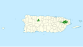 Amazona vittata map.svg 1,058 × 595; 128 KB
-
 Amazona xantholora map.svg 1,382 × 820; 179 KB
-
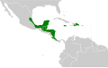
 América - Distribuição de araras.PNG 804 × 791; 43 KB
-
 Anodorhynchus glaucus map.svg 1,181 × 1,732; 1.89 MB
-
 Anodorhynchus hyacinthinus map.svg 1,181 × 1,732; 1.91 MB
-
 Anodorhynchus leari map.svg 2,008 × 1,984; 572 KB
-
.jpg/120px-Anodorhynus_hyacinthinus_range_(cropped).jpg) Anodorhynus hyacinthinus range (cropped).jpg 153 × 231; 12 KB
Anodorhynus hyacinthinus range (cropped).jpg 153 × 231; 12 KB
-
 Anodorhynus hyacinthinus range.jpg 888 × 531; 66 KB
-
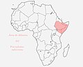
 Approximate range of the Niam-Niam Parrot.png 510 × 302; 95 KB
-
 Ara ambigua distribution cropped.jpg 232 × 285; 42 KB
-
 Ara ambiguaVC-s.jpg 888 × 531; 85 KB
-
 Ara glaucogularis map.svg 1,342 × 1,488; 253 KB
-
 Ara macaoterritorium.jpg 888 × 531; 86 KB
-
 Ara militaris distribution map.png 640 × 777; 63 KB
-
 Ara militaris distribution.png 640 × 777; 62 KB
-
 Ara militarisVC-s.jpg 888 × 531; 86 KB
-
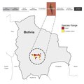
 Ara rubrogenys map.svg 1,342 × 1,488; 254 KB
-
 Ara severa -range map -VC-s.jpg 888 × 531; 85 KB
-
 Ara tricolor range map without borders.png 250 × 115; 18 KB
-
 Ara tricolor range map.png 250 × 115; 4 KB
-
 Aratinga auricapillus map.svg 2,008 × 1,984; 580 KB
-
 Aratinga jandaya map.svg 2,008 × 1,984; 624 KB
-
 Aratinga maculata map.svg 2,008 × 1,984; 573 KB
-
 Aratinga nenday map.svg 389 × 377; 500 KB
-
 Aratinga solstitialis map.svg 1,181 × 1,732; 1.89 MB
-
 Aratinga weddellii map.svg 1,181 × 1,732; 1.93 MB
-

-
 Arearufiventris.jpg 771 × 621; 33 KB
-
 Bolborhynchus ferrugineifrons map.svg 1,379 × 1,864; 369 KB
-
 Bolborhynchus lineola map.svg 740 × 800; 213 KB
-
 Bolborhynchus orbygnesius map.svg 1,181 × 1,732; 1.9 MB
-
 Brotogeris chiriri map.svg 389 × 377; 501 KB
-
 Brotogeris chrysoptera map.svg 1,181 × 1,732; 1.98 MB
-
 Brotogeris cyanoptera map.svg 1,181 × 1,732; 1.93 MB
-
 Brotogeris jugularis map.svg 1,367 × 856; 103 KB
-
 Brotogeris pyrrhoptera map.svg 1,535 × 1,654; 632 KB
-
 Brotogeris sanctithomae map.svg 1,181 × 1,732; 1.95 MB
-
 Brotogeris tirica map.svg 2,008 × 1,984; 604 KB
-
 Brotogeris versicolurus map.svg 389 × 377; 508 KB
-
 Cape parrot range.png 1,198 × 887; 1.31 MB
-
 Cape Parrot, range.png 434 × 431; 81 KB
-
 Cyanopsitta spixii map.svg 2,008 × 1,984; 577 KB
-
 Deroptyus accipitrinus map.svg 1,181 × 1,732; 1.97 MB
-
 Difusionjardinero.jpg 678 × 695; 122 KB
-
 Difusionmeyeri.jpg 650 × 675; 132 KB
-
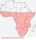 Difusionpoicephalus.jpg 585 × 648; 34 KB
-
 Difusionsenegal.jpg 566 × 613; 126 KB
-
 Difusiónflavifrons.jpg 370 × 430; 33 KB
-
 Diopsittaca cumanensis map.svg 1,181 × 1,732; 1.93 MB
-
 Diopsittaca nobilis map 2.svg 1,181 × 1,732; 1.96 MB
-
 Diopsittaca nobilis map.svg 1,181 × 1,732; 1.91 MB
-
 Diopsittaca nobilisVC-s.jpg 888 × 531; 86 KB
-
 Distribuicao-geografica-amazona-vinacea.png 240 × 320; 3 KB
-
 Distribuicao-geografica-anodorhynchus-lean.png 240 × 320; 3 KB
-
 Distribution Ara ararauna.svg 795 × 1,070; 493 KB
-
 Distribution Ara chloropterus.svg 795 × 1,070; 484 KB
-
 Distribution Ara macao.svg 1,000 × 1,214; 532 KB
-
 Distribution Ara severa.png 640 × 777; 75 KB
-
 Distribution map.png 874 × 1,365; 149 KB
-
 Enicognathus areal.JPG 658 × 391; 36 KB
-
 Enicognathus ferrugineus map.svg 1,418 × 2,412; 2.08 MB
-
 Eupsittula aurea map.svg 1,181 × 1,732; 1.96 MB
-
 Eupsittula cactorum map.svg 2,008 × 1,984; 606 KB
-
 Eupsittula canicularis map.svg 1,382 × 820; 183 KB
-
 Eupsittula nana map.svg 1,367 × 856; 99 KB
-
 Eupsittula pertinax map.svg 740 × 700; 269 KB
-
 Forpus coelestis map.svg 1,181 × 1,732; 1.9 MB
-
 Forpus conspicillatus map.svg 454 × 608; 112 KB
-
 Forpus cyanopygius map.svg 1,000 × 680; 135 KB
-
 Forpus modestus map.svg 1,181 × 1,732; 1.97 MB
-
 Forpus passerinus map.svg 1,181 × 1,732; 1.97 MB
-
 Forpus spengeli map.svg 1,379 × 1,864; 366 KB
-
 Forpus xanthops map.svg 820 × 1,000; 1,021 KB
-
 Forpus xanthopterygius map.svg 1,181 × 1,732; 1.97 MB
-
 Gebirgsara topo.jpg 883 × 482; 67 KB
-
 Glaucogulari area.png 212 × 319; 6 KB
-
 Graydidascalus brachyurus map.svg 1,181 × 1,732; 1.94 MB
-
 Hapalopsittaca amazonina map.svg 2,027 × 2,294; 767 KB
-
 Hapalopsittaca fuertesi map.svg 1,379 × 1,864; 361 KB
-
 Hapalopsittaca melanotis map.svg 1,181 × 1,732; 1.89 MB
-
 Hapalopsittaca pyrrhops map.svg 1,181 × 1,732; 1.89 MB
-
 Hyacinth area.png 212 × 319; 6 KB
-
 Leptosittaca branickii map.svg 1,181 × 1,732; 1.9 MB
-
 Maracana topo.jpg 462 × 468; 104 KB
-
 Meyer's Parrot, range & races.png 499 × 409; 43 KB
-
 Myiopsitta monachus map.svg 1,181 × 1,732; 1.95 MB
-
 Myiopsitta monachus subspecies.png 626 × 740; 95 KB
-
 Nannopsittaca dachilleae map.svg 1,181 × 1,732; 1.9 MB
-
 Nannopsittaca panychlora map.svg 1,181 × 1,732; 1.89 MB
-
 Ognorhynchus icterotis map.svg 1,379 × 1,864; 367 KB
-
 Orthopsittaca manilat.png 212 × 319; 6 KB
-
 Orthopsittaca manilatus map.svg 1,181 × 1,732; 2.02 MB
-
 Pionites leucogaste.png 212 × 319; 6 KB
-
 Pionites leucogaster map.svg 1,181 × 1,732; 1.93 MB
-
 Pionites melanocephalus map.svg 1,181 × 1,732; 1.96 MB
-
 Pionopsitta pileata map.svg 1,181 × 1,732; 1.9 MB
-
 Pionus chalcopterus map.svg 1,181 × 1,732; 1.9 MB
-
 Pionus fuscus map.svg 1,181 × 1,732; 1.94 MB
-
 Pionus maximiliani map.svg 1,181 × 1,732; 1.93 MB
-
 Pionus menstruus map.svg 740 × 800; 251 KB
-
 Pionus senilis map.svg 1,382 × 820; 188 KB
-
 Pionus sordidus map.svg 1,181 × 1,732; 1.91 MB
-
 Pionus tumultuosus map.svg 1,181 × 1,732; 1.9 MB
-
 Poicephalus gulielmi - subspecies ranges in Africa.jpg 678 × 695; 109 KB
-
 Primolius auricollis map.svg 1,181 × 1,732; 1.9 MB
-
 Primolius couloni area.png 212 × 319; 6 KB
-
 Primolius couloni map.svg 1,181 × 1,732; 1.91 MB
-
 Primolius maracana map.svg 1,181 × 1,732; 1.93 MB
-
 Psilopsiagon aurifrons map.svg 1,181 × 1,732; 1.91 MB
-
 Psilopsiagon aymara map.svg 1,181 × 1,732; 1.89 MB
-
 Psittacara acuticaudatus map.svg 1,181 × 1,732; 1.93 MB
-
 Psittacara chloropterus map.svg 2,238 × 1,105; 275 KB
-
 Psittacara erythrogenys map.svg 389 × 377; 500 KB
-
 Psittacara euops map.svg 1,795 × 761; 901 KB
-
 Psittacara finschi map.svg 512 × 393; 351 KB
-
 Psittacara holochlorus map 2.svg 1,382 × 820; 175 KB
-
 Psittacara holochlorus map.svg 1,382 × 820; 179 KB
-
 Psittacara leucophthalmus map.svg 1,181 × 1,732; 2.04 MB
-
 Psittacara mitratus map.svg 1,181 × 1,732; 1.9 MB
-
 Psittacara strenuus map.svg 512 × 393; 341 KB
-
 Psittacara wagleri map.svg 1,181 × 1,732; 1.9 MB
-
 Psittacus erithacus range.jpg 888 × 531; 49 KB
-
 Psittacus erithacus range.png 1,144 × 1,177; 43 KB
-
 Pyrilia aurantiocephala map.svg 2,008 × 1,984; 576 KB
-
 Pyrilia barrabandi map.svg 1,181 × 1,732; 1.95 MB
-
 Pyrilia caica map.svg 1,181 × 1,732; 1.91 MB
-
 Pyrilia haematotis map.svg 1,367 × 856; 99 KB
-
 Pyrilia pulchra map.svg 1,181 × 1,732; 1.89 MB
-
 Pyrilia pyrilia map.svg 1,367 × 856; 95 KB
-
 Pyrilia vulturina map.svg 2,008 × 1,984; 590 KB
-
 Pyrrhura albipectus map.svg 1,535 × 1,654; 604 KB
-
 Pyrrhura amazonum map.svg 1,181 × 1,732; 1.9 MB
-
 Pyrrhura caeruleiceps Range Map.png 148 × 110; 3 KB
-
 Pyrrhura calliptera map.svg 1,379 × 1,864; 361 KB
-
 Pyrrhura cruentata map.svg 2,008 × 1,984; 575 KB
-
 Pyrrhura devillei map.svg 1,181 × 1,732; 1.89 MB
-
 Pyrrhura egregia map.svg 1,181 × 1,732; 1.89 MB
-
 Pyrrhura eisenmanni range map.png 195 × 219; 8 KB
-
 Pyrrhura frontalis map.svg 1,181 × 1,732; 1.91 MB
-
 Pyrrhura griseipectus map.svg 2,008 × 1,984; 571 KB
-
 Pyrrhura hoematotis map.svg 1,648 × 1,479; 1.24 MB
-
 Pyrrhura hoffmanni map.svg 512 × 393; 303 KB
-
 Pyrrhura lepida map.svg 2,008 × 1,984; 603 KB
-
 Pyrrhura leucotis map.svg 2,008 × 1,984; 580 KB
-
 Pyrrhura lucianii map.svg 2,008 × 1,984; 573 KB
-
 Pyrrhura melanura map.svg 1,181 × 1,732; 1.93 MB
-
 Pyrrhura molinae map.svg 1,181 × 1,732; 1.9 MB
-
 Pyrrhura molinae range.jpg 1,248 × 1,634; 92 KB
-
 Pyrrhura orcesi map.svg 1,535 × 1,654; 601 KB
-
 Pyrrhura perlata map.svg 1,181 × 1,732; 1.9 MB
-
 Pyrrhura pfrimeri map.svg 2,008 × 1,984; 571 KB
-
 Pyrrhura picta map.svg 454 × 608; 119 KB
-
 Pyrrhura rhodocephala map.svg 1,648 × 1,479; 1.24 MB
-
 Pyrrhura roseifrons map.svg 1,181 × 1,732; 1.91 MB
-
 Pyrrhura rupicola map.svg 1,181 × 1,732; 1.9 MB
-
 Pyrrhura snethlageae Range Map.png 240 × 320; 2 KB
-
 Pyrrhura viridicata map.svg 1,379 × 1,864; 357 KB
-
 Red-fronted macaw species range.pdf 2,250 × 2,250; 91 KB
-
 Rhynchopsitta pachyrhyncha map.svg 1,000 × 680; 140 KB
-
 Rhynchopsitta terrisi map.svg 1,000 × 680; 131 KB
-
 Rubrogenys area.png 212 × 319; 6 KB
-
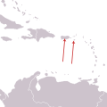 Saint-Croix-Macaw-Dist.svg 300 × 300; 15 KB
-
 Svet Ara.gif 356 × 183; 4 KB
-
 Timnehdist.gif 1,144 × 1,177; 24 KB
-
 Touit batavicus map.svg 1,181 × 1,732; 1.9 MB
-
 Touit costaricensis map.svg 512 × 393; 313 KB
-
 Touit dilectissimus map.svg 454 × 608; 135 KB
-
 Touit huetii map.svg 1,181 × 1,732; 1.97 MB
-
 Touit melanonotus map.svg 2,008 × 1,984; 581 KB
-
 Touit purpuratus map.svg 1,181 × 1,732; 1.97 MB


.jpg)


